Video or image

The benefits of measuring soil variability
When soil sampling, we usually collect the sample by block or by paddock. This is purely driven by ease of sampling logistics, such as crop area or fencing around a paddock, rather than yield variability and soil type, which in fact have the biggest influence on available plant nutrient.
Zonal soil sampling uses knowledge of historical management and spatial factors to direct where to take samples and determine if these areas have different fertiliser needs. Tools such as yield maps, crop sensor maps, Electro Magnetic (EM) soil maps and aerial imagery provide more information about variability in the field and where soil sampling can help interpret variability.
Soil depth and texture (sand, silt, and clay) change constantly across a paddock, impacting on the soil’s ability to hold on to moisture and nutrients, for instance a sandy soil has a lower water and nutrient holding capacity than a clay soil. By measuring the variability in sand, silt, and clay across a paddock and plotting it using GPS, we can create a map showing zones by soil texture and then sample those areas separately. This can be done either by a soil scientist taking soil cores and creating a soil classification report, or by using a scanning device such as an Electro Magnetic (EM) scanner or an Electrical Conductivity (EC) scanner.
The scanner is towed across the paddock or area to be scanned usually at 12 metres swaths and sends an electrical pulse into the soil about every second as it drives forwards. The electrical pulse then bounces back to a receiver on the scanner having arced through moisture in the soils pores. Then, with the aid of an algorithm, a geo located reading of the soil porosity is done linking to the soil particle size and giving a soil texture indication.
A map is then created showing areas of soil texture change which can be sampled separately. A fertiliser plan can then be created by zone rather than by paddock. The spreader used must have the ability to variably apply fertiliser or lime. The map can also be used to variably apply seed, slug bait and even cultivations and help place soil moisture probes if you have irrigation.
The benefits of measuring soil variability are that you can apply lime and plant nutrients where they are required instead of carrying out a blanket application across the area to be fertilised. There are potential savings and environmental benefits by avoiding over fertilising areas, and crop output benefits from not under-fertilising areas, however the jury is still out with proven benefits of variable applied nitrogen (N).
For more information on zonal soil sampling, please speak to your local PGG Wrightson Technical Field Representative.
Related News
Video or image
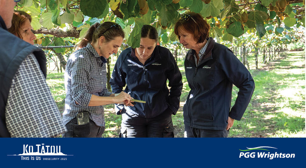
PGG Wrightson signs Biosecurity Pledge
Aotearoa New Zealand sits in a unique position being an isolated island nation which has historically protected it from a number of pests and diseases found elsewhere, but the high volume of trade and tourism increases the risk of them getting across the border. Biosecurity is a major risk to...
Video or image

Sheffield Primary receives boost from Cash for Communities Programme
Raising funds to provide Kiwi kids with additional resources and equipment to enjoy while at school takes considerable time and effort in fundraising. For Sheffield Primary School in Mid Canterbury, the Cash for Communities programme delivered a win recently with the school being donated $333. Nigel...
Video or image
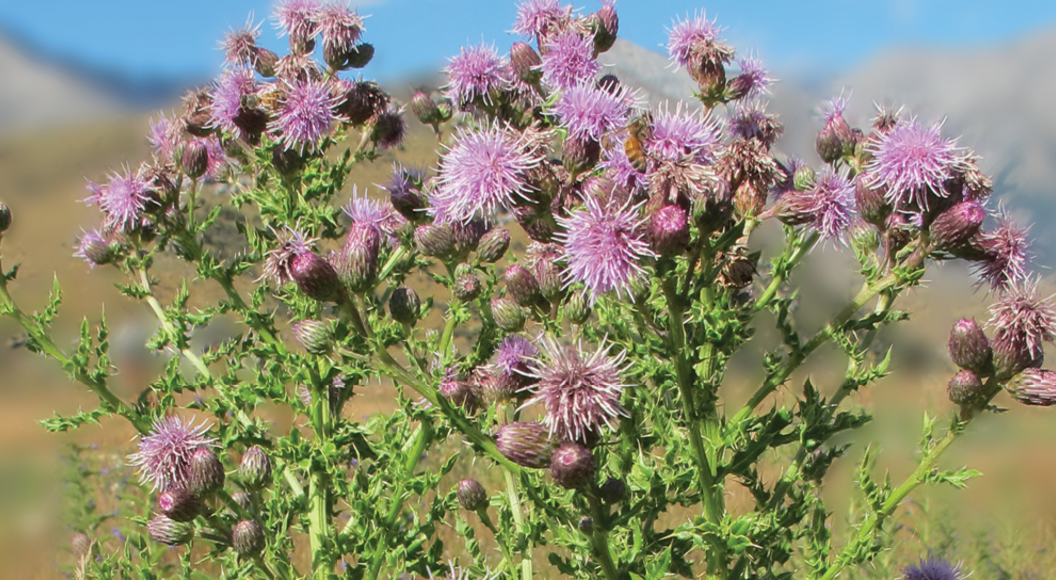
Perennial weed control in new and established pastures
Perennial weeds grow from one year to the next, usually from a large root system or root chip. New generations usually flower and seed in late summer and the parent plant normally shuts down over winter, lives off the energy reserves in its roots, then wakes up in the spring to continue growing...
Video or image
PGG Wrightson signs Biosecurity Pledge
Aotearoa New Zealand sits in a unique position being an isolated island nation which has historically protected it from a number of pests and diseases found elsewhere, but the high volume of trade and tourism increases the risk of them getting across the border. Biosecurity is a major risk to...
Video or image
Sheffield Primary receives boost from Cash for Communities Programme
Raising funds to provide Kiwi kids with additional resources and equipment to enjoy while at school takes considerable time and effort in fundraising. For Sheffield Primary School in Mid Canterbury, the Cash for Communities programme delivered a win recently with the school being donated $333. Nigel...
Video or image
Perennial weed control in new and established pastures
Perennial weeds grow from one year to the next, usually from a large root system or root chip. New generations usually flower and seed in late summer and the parent plant normally shuts down over winter, lives off the energy reserves in its roots, then wakes up in the spring to continue growing...